Summit To Sea: Bigelow Preserve
After their Fourth of July trip to the Bigelows, Teton spent some time studying a map of the Bigelow Preserve that he had received from Maine High Peaks, an organization in charge of information on the region. During this time he saw that a full circumnavigational trip was possible via trail and paddle. A test in logistical trip planning and organization, Teton sought an adventure that would be both challenging and varied. He created a three day route that would play out as follows:
- Morning of day one, stash two boats with full resupply on the eastern shore of Flagstaff Lake
- Drive to the opposite, western side of the range and park the car near boat access in Stratton
- Hike 9 miles along the Bigelow Range to Avery Col and camp for the night
- Day two, hike the remaining 8.6 miles back to the boats stashed on the shore
- Paddle 7.6 miles to Hurricane Island and camp for the night
- Day three, paddle the remaining 11.5 miles back to the western shore, to the parked car
The plan was to get to the south eastern shore of Flagstaff Lake by the break of dawn, so Teton and Birch left Portland at 4 AM. We drove north in complete darkness and arrived at the preserve around 7 AM. We knew the general location of where to ditch the kayaks, but we didn't know exactly where we would end up putting them until scoping out the shoreline. Luckily, there was a perfect place a few yards north of where the trail dumps out onto East Flagstaff Road (the A.T. follows East Flagstaff Rd for .1 mile). There is a carry-in (boat access) point right off East Flagstaff Road in the same vicinity, but we passed on that for a more secluded spot.
Our boats were loaded with a full resupply of food, water, and gear for the second half of the trip, so we were vigilant about hiding them. We first wrapped them in a tarp and then covered them with logs, sticks, and branches. Once everything was secure and sufficiently hidden we hopped back in the car and headed west towards Stratton on the other side of the mountain range. The drive took a mere 30 minutes via the Carriage Road (a rough, dirt road which is not open during the winter). Once in Stratton, we looked for a place to park the car. With permission, we were able to park at the school that sits across the street from the launch. From the car, we were only a short .8 mile road walk to Curry Street which takes you .3 mile north to the trailhead. Before we turned onto Curry St., we stopped at the Looney Moose Cafe for a great and much needed breakfast.
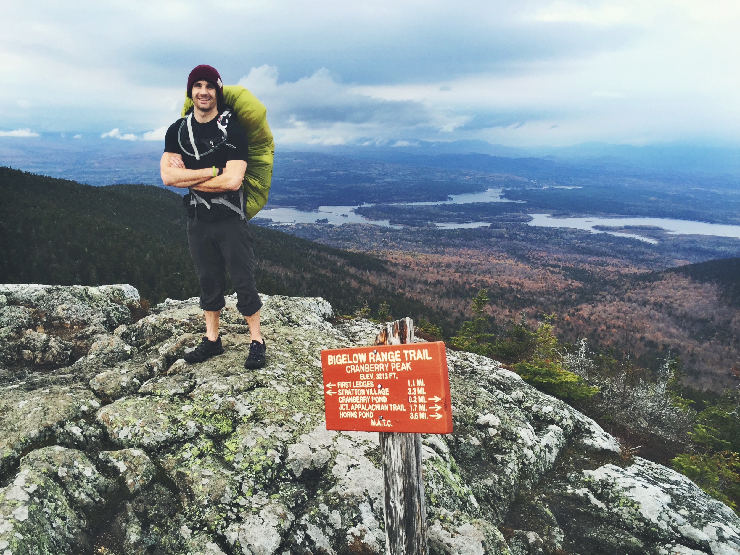
The Range Trail begins with an aggressive uphill haul to Cranberry Peak (#2 on the map elevation profile). This is a very challenging hike! The Bigelow Range is notoriously difficult due to its constant ups and downs (10,000 ft. of total elevation change), it was ranked by Backpacker Magazine as one of the top 10 hardest day hikes in America back in 2005.


After taking in the views on Cranberry Peak, we followed the trail to lower ground and eventually around the secluded Cranberry Pond (#3 on the map elevation profile). This lovely mountain pond host nice scenery, but hikers are warned not to camp along it shores since its waters tests positive for Giardia. Always eager to spot wild moose, it was here that we found our one and only sign of their existence. The fresh moose droppings lingered near the water's edge, a potential explanation for the virus's existence.
Shortly after passing Cranberry Pond, the Appalachian Trail intersects and follows the Range Trail for the remainder of the mountain range. We continued hiking, now in ascent, towards our predicted lunch spot, the Horn's Pond Overlook.
The Horn's Pond Overlook, pictured below, is one of those magical places that make the Bigelows so special. The open faced boulder overlooks the two Horns and Horn's Pond nestled in their basin. It is a great lunch spot and the perfect place to recollect for the next leg of the journey.
After lunch we hiked down around the Horn's Pond and up to the top of the South Horn. The South Horn provides an expansive view of the range and also provides the first look at West Peak (the tallest peak in the range). From here you have the option to visit the North Horn via a spur trail. From the Horns you head back down before the final climb up to West Peak.
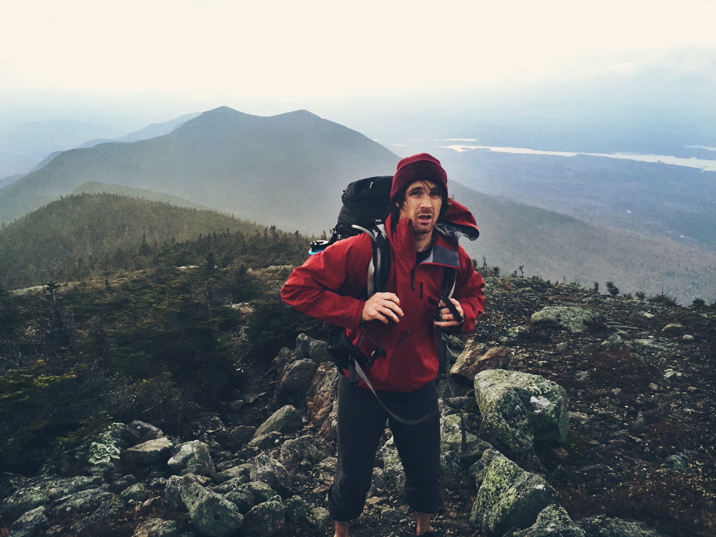
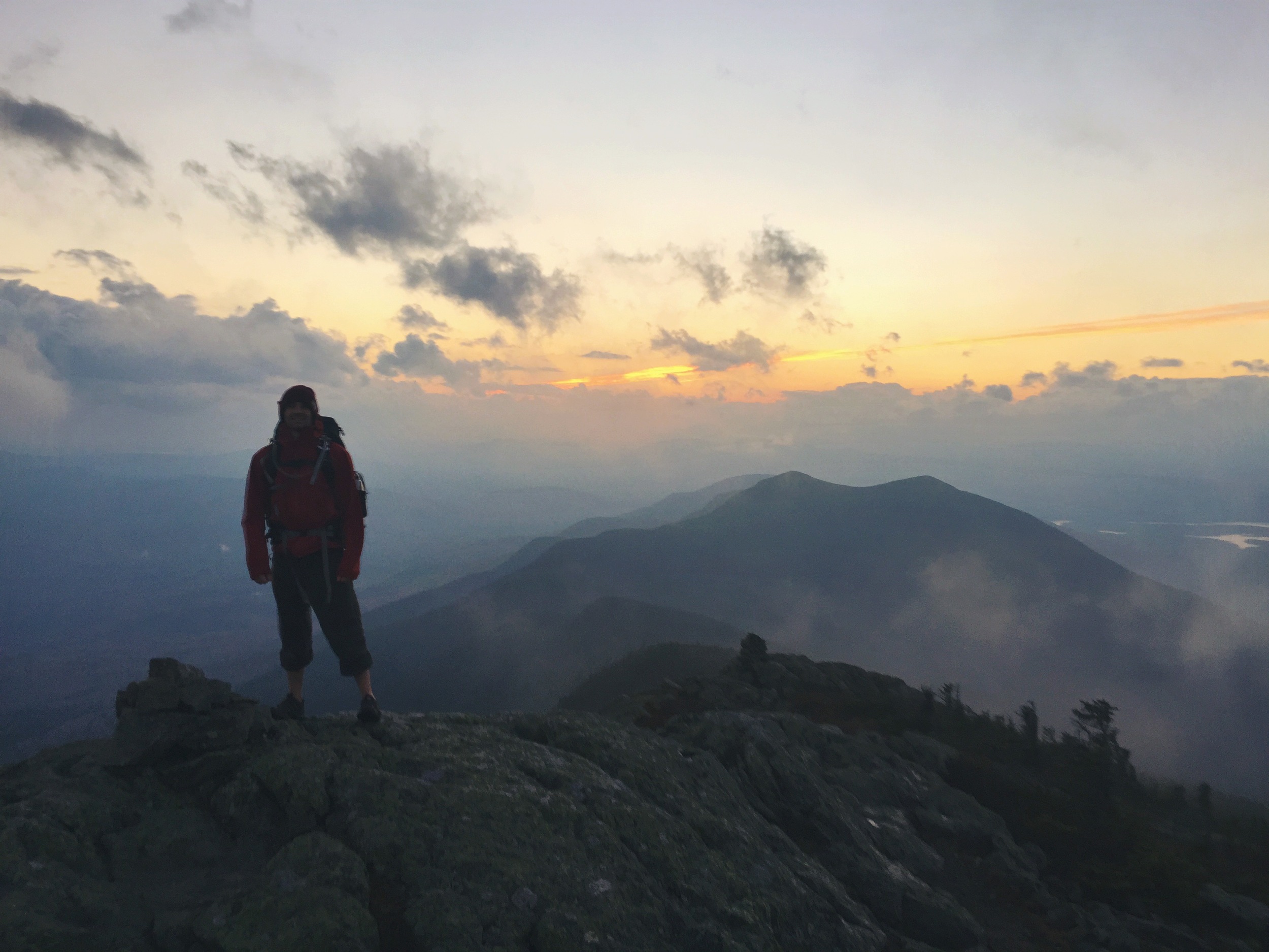
We stayed at the summit of West Peak for only a few minutes as the wind was holding steady at a burly 45 mph and we were quickly losing daylight. After a quick .4 mile decent, we made it down to Avery Col (#7 on the map elevation profile and our campsite) right at dusk and we set up camp in the dark. We were traveling ultralight for the two day-one overnight trek and our clean water was limited. We unsuccessfully attempted to gather water from the water source on the Fire Warden's Trail, only collecting a mere 20 oz. from the barely dripping source. We split the gathered water to cook in hopes of finishing the trip without having to filter water at all.


That night the mercury dropped below freezing; the Avery Col campsites feature raised tent pads (this is a method used to diminish impact on an area from camping), which we eventually learned should be avoided at all cost when cold-weather camping! The raised floor of a tent pad means cold air can circulate under and around the entire sleeping surface, similar to what happens when hammock camping. Without solid ground to build insulation and warmth, our body heat was quickly zapped out of our high R-Value rated air mattresses. Even though we didn't sleep very well, we still got going at the break of dawn. We quickly made fresh coffee and downed some oatmeal before heading up the frosted trail to Avery Peak.
After Avery, we started our gradual descent to Little Bigelow Mountain.
The descent from Little Bigelow is fairly gradual and offers many views of Flagstaff Lake. We stopped briefly at the Little Bigelow Shelter for a snack and to write in the log book and then wrapped up the hiking phase of the trip.
We were a bit weary but excited to have the 17.6 mile hike behind us. We looked forward to lunch which we promptly consumed shoreside. After eating, we recovered the boats and reorganized our gear for the second phase of the trip. We both donned our cold weather outfits in preparation for the chilly 6.7 mile paddle we had ahead of us. Teton wore a semi dry-suit and Birch wore his triathlon wetsuit for the windy, 40° and dropping conditions.
We were a bit behind schedule and losing day light quickly. The conditions on the water were bad and worsening due to the strong afternoon winds. We hit the water at 4 PM and it was slow moving from the start. As soon as we left the shelter of the small cove, we were blasted with the full force of the wind. To make situations worse, Birch's kayak was not fairing well in the strong wind and was aggressively taking on water through the bulkhead and cockpit. We were forced to run ashore twice to dump and pump his boat clear of water. These delays and the slow 1.5 mile pace only afforded us three miles before darkness. We paddled into the freezing night hoping for the wind to let up, but it didn't cooperate. At five miles, we had reached the vicinity of the Round Barn shoreline camp sites. Teton was familiar with this area from his previous visit to the lake and was able to navigate it in the dark. We paused on the island off the shore of Round Barn to discuss whether to continue on or not. It was another 2.6 mile paddle to Hurricane Island (our planned destination), it was completely dark although the moon shined bright, and we were both cold and wet, freezing. It was 7:15 PM, we had 13.6 miles behind us so we decided to cut our loses and add the 2.6 remaining miles to the next day's paddle in hopes for better weather. We paddled to the mainland where we found a campsite that offered a break from the wind. A campfire was built, a line was hung to begin drying everything out, we cooked brats on a stick and went to bed.
We were up at 5 AM to get an early start on the long day ahead. Freezing temperatures throughout the night froze our water and everything was coated in frost and ice including our paddles. The 2.6 mile paddle to Hurricane Island was hellish for Teton who had both hands go numb from the icy paddle he gripped in his hands. The cold pierced his 2mm neoprene gloves and the reflective liner gloves he was wearing and sent needles to his fingers. Luckily, we both were prepared with hand warmers, so Teton stuffed two inside his gloves once we landed on the island. We readjusted layers, warmed up and had a snack before launching onward.
We lucked out and had gorgeous conditions with little to no wind for the entire day! It eventually warmed up as the day went on and we knocked out miles as we slowly traversed Flagstaff in its entirety. Besides each other, our only accompaniment was various loon couples and their juveniles. We eventually stopped for lunch at the western side of the lake at the Savage Farm campsite (which is an awesome spot FYI).
We arrived at our final destination, the boat launch, at 1 PM. We were excited to have paddled the entire length of Maine's fourth largest lake, and successfully complete a circumnavigation of the Bigelow Preserve. We loaded up the car and headed home.