Chasing 48: Three Days In The Pemigewasset
The snow had finally fallen in New England and we were eager to venture out to the mountains. With a couple days off work, we targeted a few more of the 4000's footers in the Whites and quickly whipped up an extended weekend plan. Leaving Portland early Friday morning, we headed to New Hampshire, drove down the Kancamagus Highway, and parked at the Lincoln Woods Trailhead. Visions of snowy mountain peaks were in our minds and our future...
Peaks covered in this trip: Galehead Mountain, Owls Head, Mt. Flume, Mt. Liberty
Projected trip plan: bag our final four peaks in the pemigewasset
DAY ONE
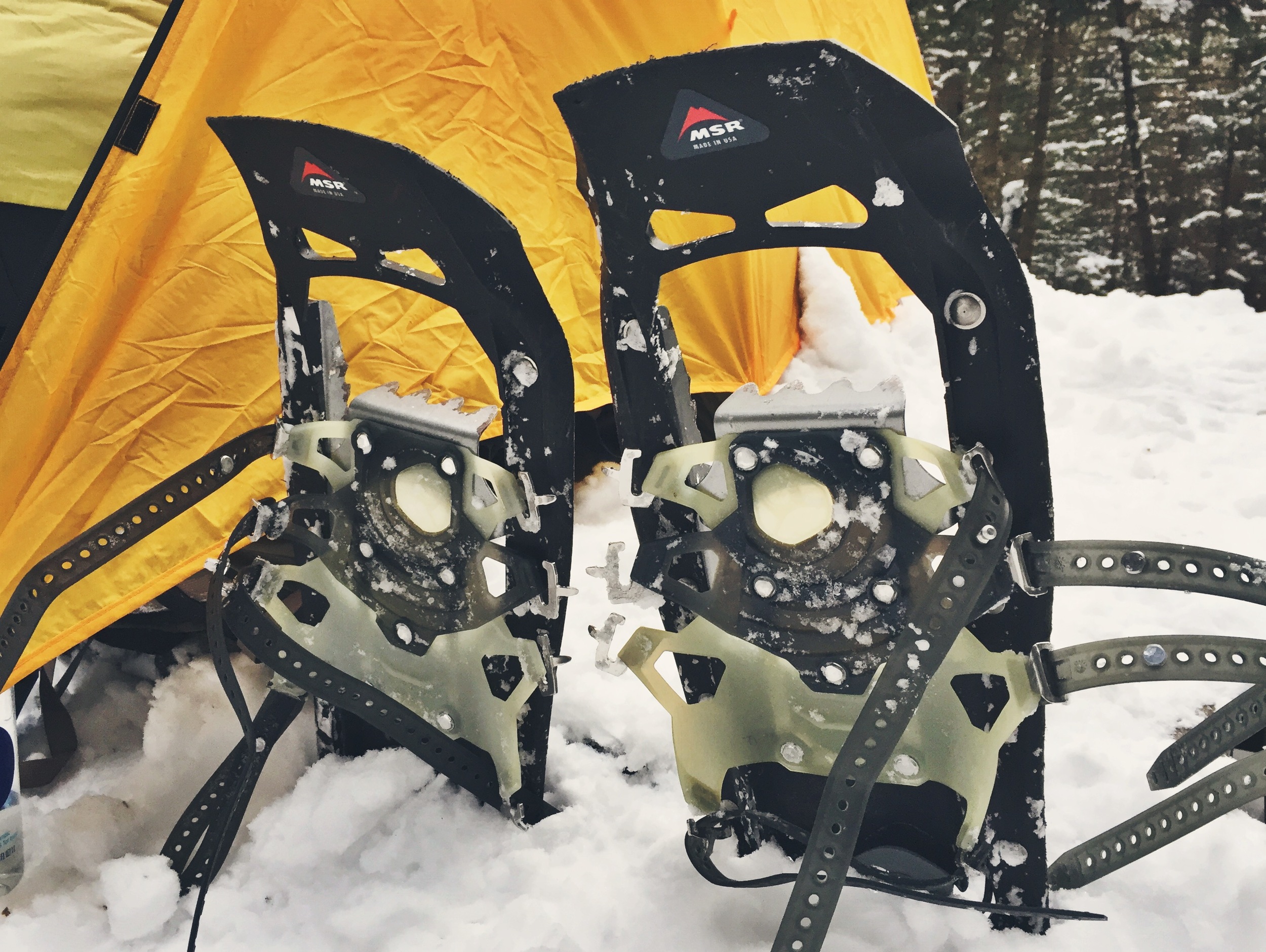
With packs loaded full for three days of winter trekking, we took off down the Lincoln Woods Trail bright and early. This trail follows an old railway for quite a while, resulting in what is a flat and easy walk in the warm weather months. On this brisk January morning, the popular XC ski trail was packed and iced over. We threw on our MICROspikes® for traction and made our way slowly down the trail.
While walking along the Lincoln Woods Trail, we entered the Pemigewasset Wilderness area, the wild heart of the White Mountains, and our home for the next three days. This 45,000 acre area is notorious for being poorly maintained with signage that is far from adequate. It is suggested that visitors be skilled with a map and compass to be fully prepared.


We encountered unexpected obstacles during this cold winter hike - multiple stream and river crossings. During warm weather months, it is easy to find safe and stable footing on large rocks in order to navigate across. Similarly, during the freezing winter months, the waterways would generally ice over completely allowing safe passage. Due to the abnormally warm winter we had seen thus far, the rivers were in a state of precarious transition, partially iced and unnervingly fragile. Our steps were blind and daunting due to ice and snow cover and our boots frequently broke through and dislodged the frozen build up. Using our poles to read the ice ahead of us, we poked and prodded the blocks to determine their security. We were forced to walk slowly and carefully over these rivers and streams, many times searching beyond the trails confines to find a safe route in order to eliminate the risk of falling in the freezing water.
We left the Lincoln Woods Trail after a short 2.6 miles and headed north on the Franconia Brook Trail. This path would carry us another 5.2 miles to 13 Falls camp site. Our camp for night one and the basecamp for our Galehead Mountain climb that we scheduled for that afternoon. The going proved to be much slower than we had planned as the Franconia Brook Trail was untouched and poorly marked. This meant that we spent a lot of energy breaking trail and checking our compass often to make sure we were still on track. We strapped on our snow shoes for loft and increased traction and trudged through the snow. Even with minimal elevation gain, the short 5.2 mile trek took us much longer than we had hoped. Luckily, a coyote had passed through just before us and acted as a guide. We put our faith in his knowledge and found our trail marked by his tracks all the way to our camp.
We arrived at 13 Falls much later than intended and decisions needed to be made. Next on our agenda was a hike up Galehead Mountain, 6.4 miles round trip. We would hike up and back down using the same trail, which allowed us the luxury of leaving our camping gear and supplies at the tent. By the time we established camp it was 3:30 in the afternoon and the sun was beginning to set behind the mountains around us. We figured our best option was to call it quits for the night and to hit the trail early in the morning.

END OF DAY 01 SPECS: 8.03 total miles: START Lincoln Woods TH - Lincoln Woods Trail - Franconia Brook Trail - 13 Falls Camp (night one) ELEVATION PROFILE
DAY TWO
We were up with the sun on day two. We had more miles ahead of us than we had planned and needed to get a strong start for our ascent of Galehead Mountain. After downing some fresh coffee and oatmeal, we strapped on the snowshoes and hit the trail. We decided to leave the tent and extra gear at camp to lighten our loads, knowing that we could retrieve the items upon return.


It didn't take us long to realize that we were in for a long day on Galehead Mountain. It seemed as though not one single person had been through this wilderness all winter. With zero markings, we were forced to use our seasoned trail instincts to blaze the trail up the mountain. With the trees hanging heavy from the weight of the snow and no trodden path to follow, it was anyone's guess as to where the trail weaved through the thick woods. We had to separate countless times to follow what could be possible paths to their inevitable dead end. At times, as we gained elevation, the snow would get thigh deep and the "trail" was a mere two foot clearing which we clawed through by hand and knee. We kept our eyes peeled for evidence of trail maintenance. Spotting a machine cut branch every 45-50 minutes was reassurance that we were on the right track.
We were ecstatic to finally come across the Galehead Hut forest protection sign! This meant that we were close and that we had actually blazed a true trail to the summit.


Excited to have successfully blazed up the mountain, we hopped on the Frost Trail- a short half mile spur trail to the summit of Galehead Mountain.
We enjoyed a quick snack at the summit before heading back down. With the advent of our newly worn path, we found the descent to be much more enjoyable - fast and much less worrisome.
We arrived back at camp at 3 PM to find our tent covered in snow. For the second time, we were way behind schedule and needed to rethink our plan. Debating our options over a quick lunch, we decided to proceed westward to get as close to Owls Head as possible. We packed up, thinking that we would abandon our original plan to hike Mt. Flume and Mt. Liberty, leaving them for another trip.
Revised trip plan: save more accessible peaks for another trip
We did not make it far! As soon as we hit the Lincoln Brook Trail, we came upon a river crossing that was too dangerous to push. Spanning nearly 25 feet wide with solid flow, we could not find a safe way across. It was littered with recklessly loose and unstable ice. There was a high chance of breaking through and getting drenched in the rivers deep flow. It was getting dark and we were a full days trek from the nearest road or exit. We debated our options and it seemed as though we only had one: to turn back and head back the way we came in. This was a bummer, because we would have to abandon our chance of summiting Owls Head, and for the third time, adjust our plans.
Revised Final trip plan: skip inaccessible Owls Head
We decided our best move would be to push mileage into the darkness to get back to the Osseo Trail, which was 6.4 miles south of our current location, at the base of Mt. Flume. With Owls Head clearly out of the picture, we now sought to tackle Mt. Flume and Mt. Liberty the following morning.
Night hiking is something the two of us are quite familiar with as we managed to do a decent amount while knocking out long mileage days on the Appalachian Trail. In this instance, we had our own tracks from the previous day to follow, so there was no worry about getting lost. The trick was managing the multitude of river and small streams crossings. Most of these were more difficult to cross since the path we had paved the day before had washed away. We spent a good amount of time searching up and down the shores looking for sturdy ice bridges.
We made it to the Osseo Trail which put an end to our 13 mile day. After hiking up the trail a quarter mile or so, we found a clearing large enough to house our tent and began setting up camp. Our sleeping bags were still soaked with condensation from the night before so we threw on every layer we had and hopped in them to warm up. We cooked up a quick dinner and went to sleep by 9 PM.
END OF DAY 02 SPECS: 13.05 total miles: 13 Falls Camp - Twin Brook Trail - Frost Trail -GALEHEAD MOUNTAIN - Frost Trail - Twin Brook Trail - Lincoln Brook Trail - DANGEROUS RIVER CROSSING - Franconia Brook Trail (night hike) - Osseo Trail Stealth Camp (night two) ELEVATION PROFILE
DAY 3
On day three we rose with excitement, the air was crisp and cold and the sky was clear. We had an 11.4 mile day ahead of us with two peaks on the radar.
We had made tentative plans before we took off for this Pemi trip to meet up with our good friend Twirls. She reported that she may join us on the final day to tackle Mt. Flume and Mt. Liberty. Without cell service in the woods of New Hampshire, our plans were never confirmed. As chance would have it, we ended day 2 at the exact place we needed to be to fulfill this questionable rendevous...
We began our hike up the Osseo Trail after filtering water and eating breakfast. About a mile up the trail we came across a note drawn in the snow for "Moose and Teton." Also inscribed was the time at which the note was written. It was Twirls! She had somehow beaten us up the trail and was only 15 minutes ahead of us! The chance of meeting up with our friend had us excited and we pushed hard up the mountain to make up time, all the while hollering "Twiiiiiiirls!" Before we knew it, we were near the top.
Mt. Flume was a gorgeous mountain! The days leading up to this peak were spent deep in the woods, with little to no views. When we reached the Flume Slide, a dangerous cliff rock slide off the southwestern side, we were gifted a spectacular view of the surrounding area.
When we reached the summit we were pleased to find our friends Twirls and Two-Thirds having a snack! We were enthused to have such an unexpected reunion in the middle of nowhere on top of a mountain.
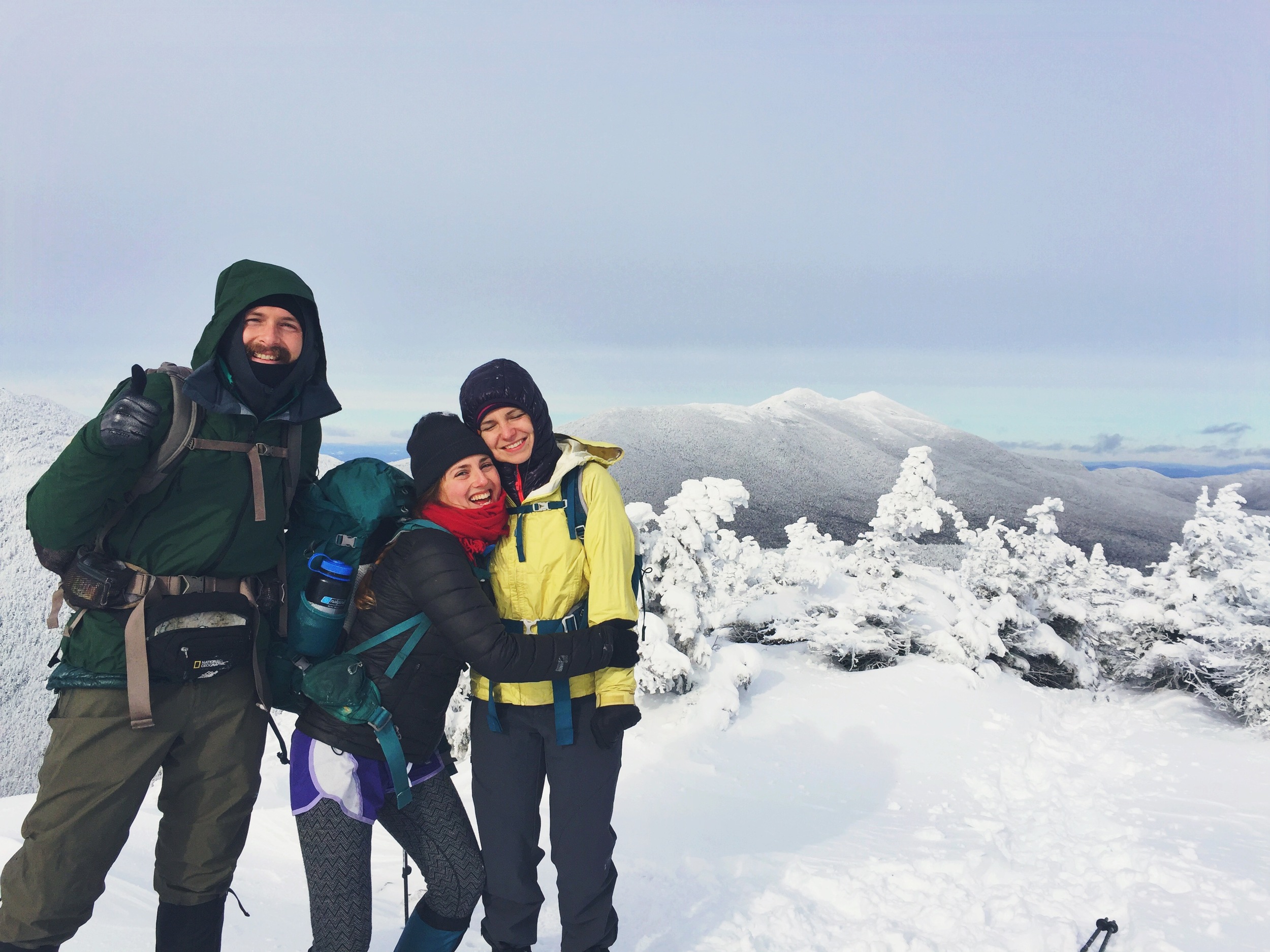
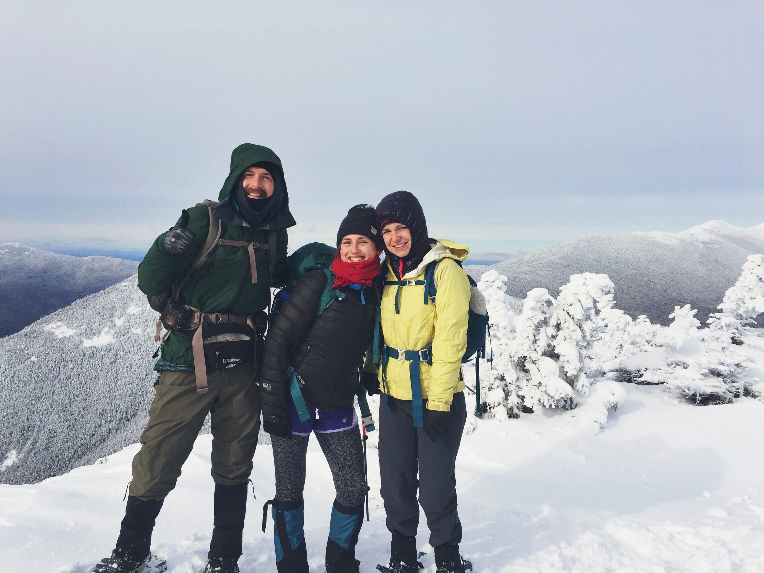
We chatted, regrouped, had a snack and added a few layers before heading off towards the next summit, Mt. Liberty.
Mt. Liberty resides only 1.2 miles from Mt. Flume. You must descend a few hundred feet from Flume and then climb back up to Liberty only to turn around and go back down Liberty and back up Flume. You essentially climb three mountains to claim two.
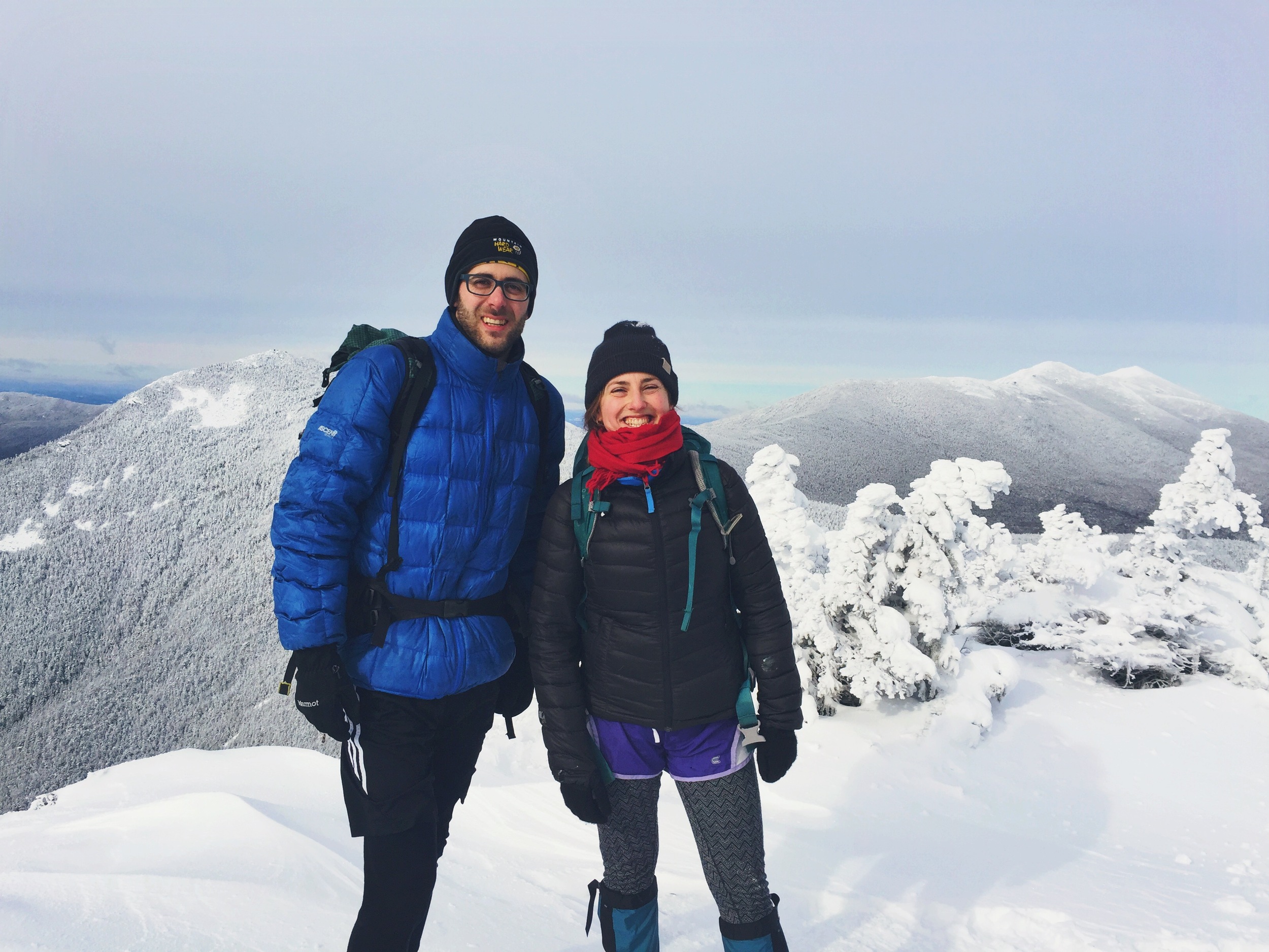
The air was eerily calm at the top of Mt. Liberty allowing us to rest comfortably at the summit. We ate a few snacks and took in the views before making our way back down.
We all made our way back down off the mountainside to our camp. We dismantled our gear and repacked our bags before making the 1.4 mile trek down the Lincoln Woods Trail back to our cars. It was a successful three day winter excursion through the White Mountain backcountry. Forced to think on our feet and adapt to the landscape, we fluidly changed our plans to conquer the most peaks we could. Even though Owls Head evaded us this time, we will certainly be back for more!
END OF DAY 03 SPECS: 12.00 total miles: Osseo Trail Stealth Camp - Osseo Trail - MT. FLUME - Franconia Ridge Trail - MT. LIBERTY - Franconia Ridge Trail - MT. FLUME - Osseo Trail - Lincoln Woods Trail - END Lincoln Woods TH ELEVATION PROFILE