Arizona's Highest
Arizona is a state of great variety. Within its landlocked borders one can find nearly every type of landscape. From lowland desert to highland forest (housing the world's largest stand of Ponderosa Pine), to deep canyons and high mountain top tundra, the nation's six largest state offers an array of recreation opportunities. Luckily for us, we have family in the state, which has given us reason to travel there every year to visit and explore.
This year, the big adventure on our list was tackling Humphreys Peak - Arizona's highest mountain. Located in the Kachina Peaks Wilderness area of the Coconino National Forest near Flagstaff, this 12,637 foot mountain claims the title of the 64th most prominent peak in the United States. The peak is the high point of the San Francisco Mountain Range, which is home to six ancient volcanic summits. Together they form an eroded bowl, the remnants of an collapsed stratovolcano that is thought to have once risen over 16,000 feet. Arizona's premier ski resort, the Arizona Snowbowl, also calls the San Francisco Mountains home and is where this adventure begins...
The peak is most accessible via the Humphreys Trail which originates from the lower slopes of the ski resort. This 4.75 mile one way trip seemed a bit short for our taste so we decided to extend our route to include Arizona's second highest mountain, Agassiz Peak. Agassiz (12,360 ft.) is a protected mountain that is illegal to climb due to it's critically threatened alpine habitat. However it is open to hikers during the winter months when the fragile land is covered by snowfall. With the addition of Agassiz, we looked to cover 11.12 total miles on this two peak jaunt.
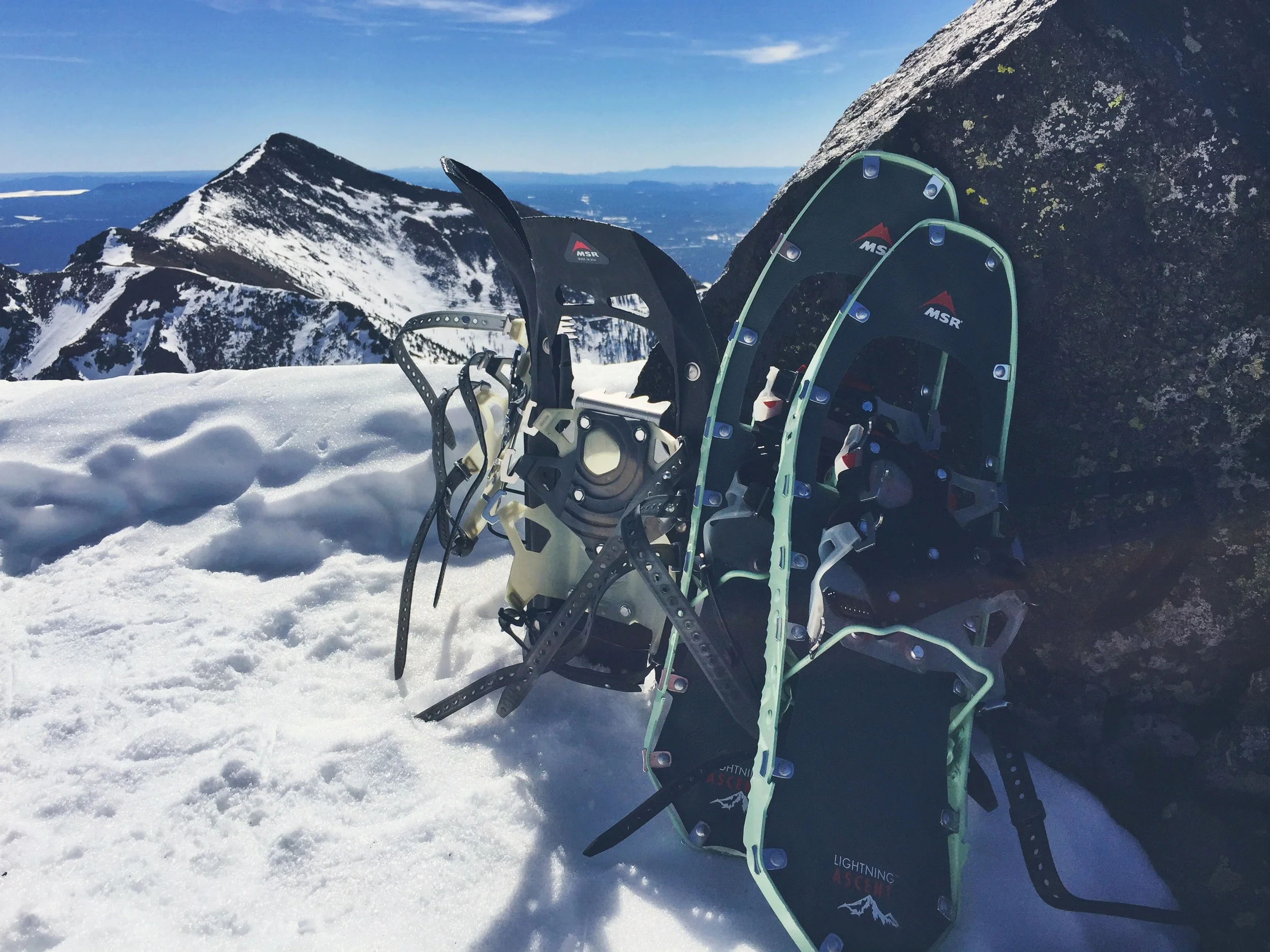
We arrived at the trailhead at 8 AM, strapped on our MICROspikes® and headed out. The first 0.3 miles of the trail crosses over the ski resorts lower training slopes, so hikers must get through this section before the slopes open up at 9 AM. Once we got past the slopes, we quickly realized that this hike would require snowshoes. A few feet in and Teton was already post-holing up to his thighs!
The trail system on the mountain differed from those found out East and went predominantly unmarked. This meant that we relied heavily on the use of our map and compass. The mountain is a popular backcountry ski area and was littered with random routes created by adventuresome skiers. We attempted to follow the outlined trail up until the fourth switchback. That would require us to go down and back up the ridge line we had followed thus far. Neither of us liked the idea of unnecessary elevation loss, so we threw out the idea of the established trail. We set our bearings for the highest reaches and began blazing our own route up the mountainside.
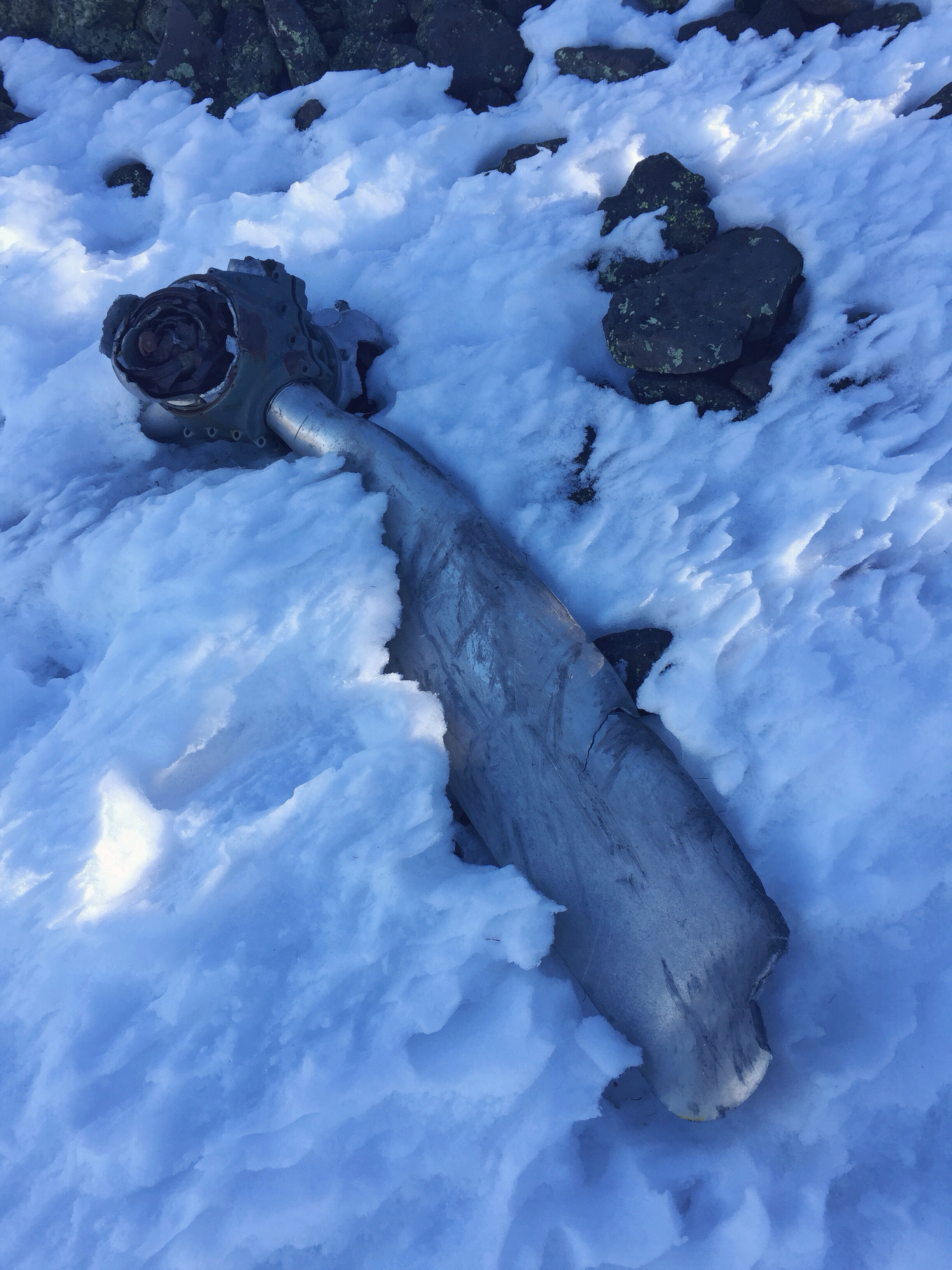
Apparently fate favors the bold. Unbeknownst to us, our invisible route brought us right upon a plane wreck in the side of the mountain. Teton had done his research before the trip and recalled reading about a lost WWII bomber plane crash site. We found all kinds of parts strewn across the mountainside. After doing more research post-hike, we learned that the crash site is frequently, and fairly unsuccessfully, sought out by hikers. It was discovered on our trip by chance and we were excited to come across such a hidden gem. To learn more about the crash site and the eight men who lost their lives in the wreckage follow this link hikearizona.com.


After we checked out the wreckage, we continued up and out of tree line onto the now barren slopes. We gradually gained altitude as we marched up the steep snow covered mountainside, enjoying the expansive views as we climbed. Following our original bearing up the ridge line, we weaved around sections of rock scree and avoided the steep ravines on either side. We had no idea where we would meet the saddle of the peak - our connector to the trail that would take us to the summit.
We eventually met up with the saddle where we linked up with the Weatherford Trail for another 1.02 miles to the summit. This section of the Weatherford Trail was amazing! It ran right along the edge of the inner basin, feet away from frighteningly steep drop offs.
Along the summit ridge we encountered several patches of exposed rock which required us to swap out our traction once again. We paused to put our MICROspikes® back on before continuing onward.

We were both pumped to reach the 12,637 ft. summit of Humphreys Peak. The sky was clear and the 360° views were tremendous. We rested for a half-hour at the top to consume calories, rehydrate, and to soak up the 54° summit sun. Shortly after arriving, we were joined by a group of three backcountry skiers who had skinned up the mountainside to ski one of the ravines back down. They snapped our picture and pointed out the surrounding mountains for us before taking off. We also decided to get moving and started back the way we came.
After back tracking across the rocky sections of the ridge, we were once again forced to throw on our snowshoes.
We hiked down to the saddle of the two peaks - where we would eventually descend back to the parking lot after ascending Agassiz Peak. By this point we started to feel, ever-so-slightly, the effects of the elevation. Our pace was off. We moved slower than we normally would on similar terrain - the downside of living next to the ocean back in Maine. None-the-less we trekked onward.
There is no trail to the top of Agassiz Peak because the Weatherford Trail, which we had been following, veers off to the eastern side of the peak, avoiding it completely. To climb it, you must follow the ridge of the peak to its highest reaches.
The hike up Agassiz was fairly grueling. Our bodies were wearing out from the altitude and no matter how long we hiked the peak never really seemed to get any closer. The never ending, steep slope was demoralizing, but we kept at it. After a couple required stops to adjust or swap out traction, we made it to the top.
We snapped a couple of pictures and had another snack before heading back down the mountain.
Once we made it back to the saddle we paused to rehydrate. By this time we were thoroughly feeling the effects of the altitude, headaches were setting in and we were starting to feel burned from the intense alpine sunshine. We looked for the route down but could not seem to find a solid path. It seemed as though most people (like ourselves) had chosen to make their own route up the mountain and therefore a path was non-existent. From the saddle, we could see the base of the ski resort where our car was parked. Teton got the bearing with his compass and we began the descent.
The descent was grueling! Our line of travel brought us down a much steeper side of the mountain. The snow was so deep that even with our snowshoes we struggled to stay aloft. What was worse was the searing sunburns that we had been unaware of until now. We attempted to cover our faces to the best of our ability in a pitiful attempt to stop what was already a raging burn. We were so angry with ourselves that we had forgotten sunscreen! When we began our hike it was 20° and dark, not a single thought of sun protection had crossed our minds, and now we would pay for it! An entire day spent above tree line, on the white reflective snow, had done a number to our skin anywhere that it had been exposed. While chasing the relief of shade we headed downward. We tried to slide down the steep slope but the deep snow held us back. We eventually managed to trudge through the trees to a ski run, where we were able to slowly walk along the edge back down to the bottom of the resort.
We happily made it back down to the parking lot at 4 o'clock. Sore from the miles, sick from the altitude, and burned from the sun, we dropped our gear and chugged some water. We were happy to have made it safely back to the car and even though we were beat, we could not hold back the smiles from the magnificent day in the mountains.